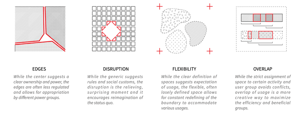
Certainty and permanency do not define Mumbai. Here, space is constantly occupied, consumed, and recreated by various people as a claim of their right to the city. The ambiguity between the representation of domestic and production, of individual and collective, of temporary and permanent leads to creativity and vitality – the essence of Mumbai.
The project seeks to explore the balance between clarity and ambiguity within the context of Mumbai. This ambiguity is different from generic. In a city where a mix of population and activities happens by default, a designer needs to be strategic in guiding the development process instead of simply accepting the status quo. I envision the Elphinstone Estate will work as a model for other parts of the eastern waterfront and potentially the city for future development.
Ambiguous Spatial Strategy
Faced with a shortage supply of open space and housing in such a densely populated city, this design seeks inspiration from creativity in the city – where there is some ambiguity within a well-supported framework.
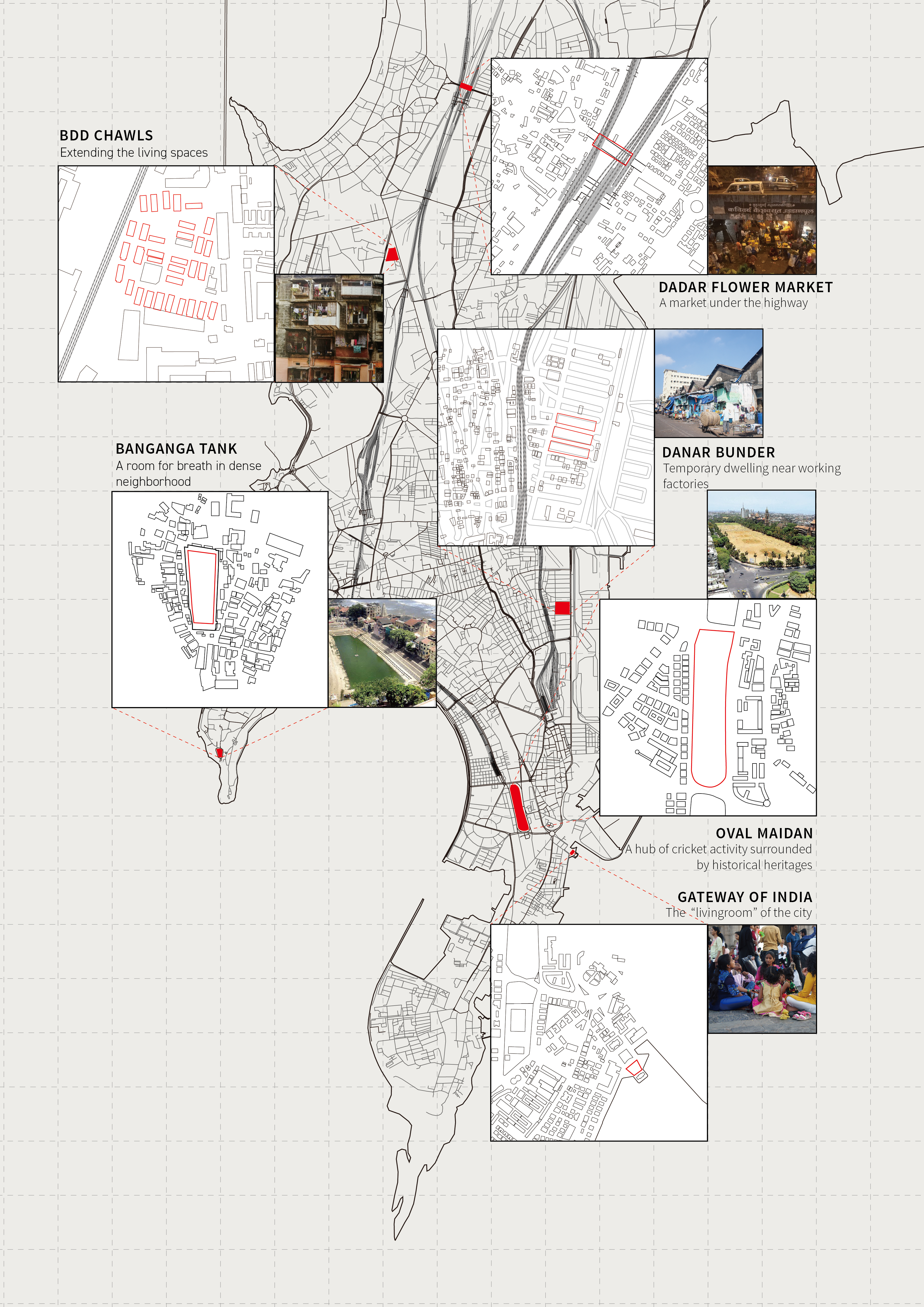
Ambiguous Spaces in Mumbai
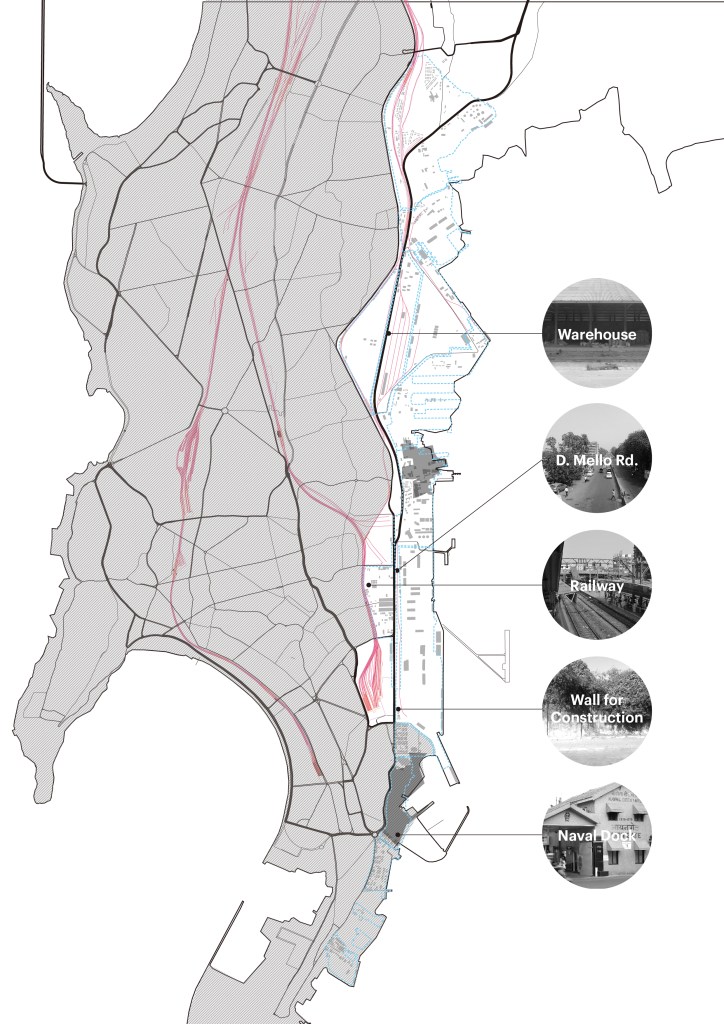
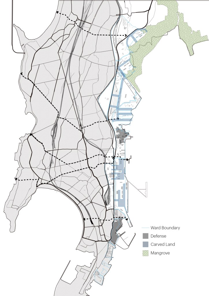
Mumbai Eastern Waterfront – 28 km Coastal Line, 730 Hectares of land is the last continuous, large developable land in the dense city.
In contrast to the claim that the area is mainly without any “productive activity” and<br>a “clean slate” development should be the approach by the government, there are various primary, auxiliary, and derivative industries that support the whole economy of the city and beyond.
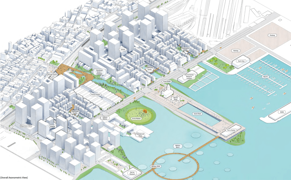
Master Plan
Challenges and Opportunities
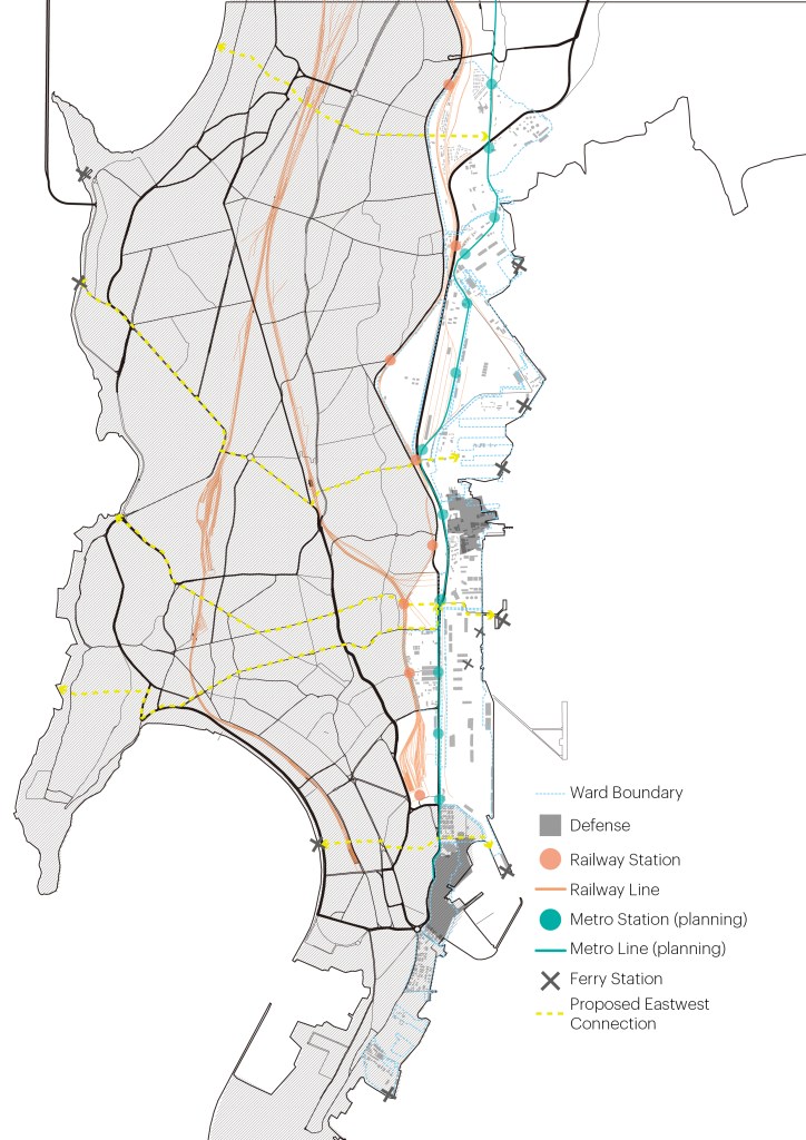
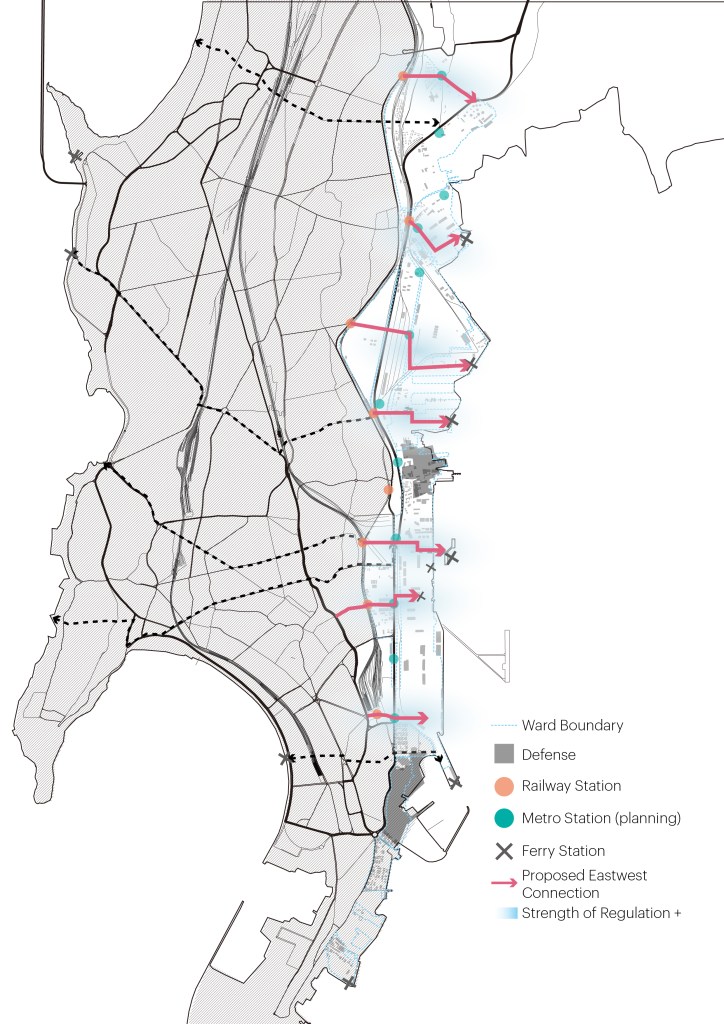
The waterfront is separated from the city grid by railway, fast traffic and industrial areas.Scattered informal settlements with bad sanitary conditions; however, they are providing services important for the overall economy.The waterfront has a dense transit network from the railway to the metro to the ferry. There is an intention to increase connectivity between the west and east waterfront as well.
Masterplanning Strategies
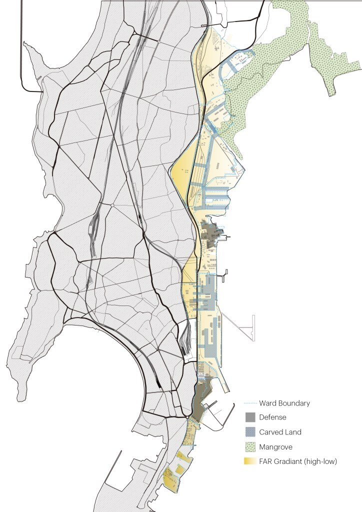
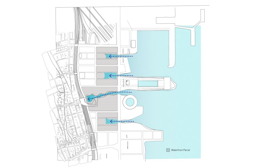
Create access corridors linking the inland to the waterfront through critical neighborhoods and transit nodes.Bring water to the inland to increase waterfront development areas and provide more public open space.Control a gradient of FAR that decreases towards the water to ensure a view out and prevent building “walls” along the waterfront.
Urban Design
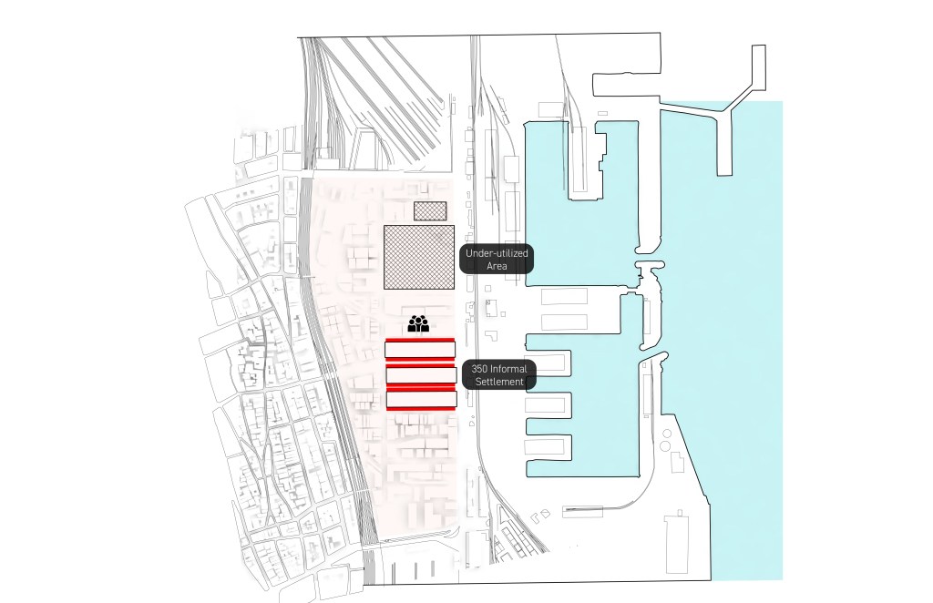
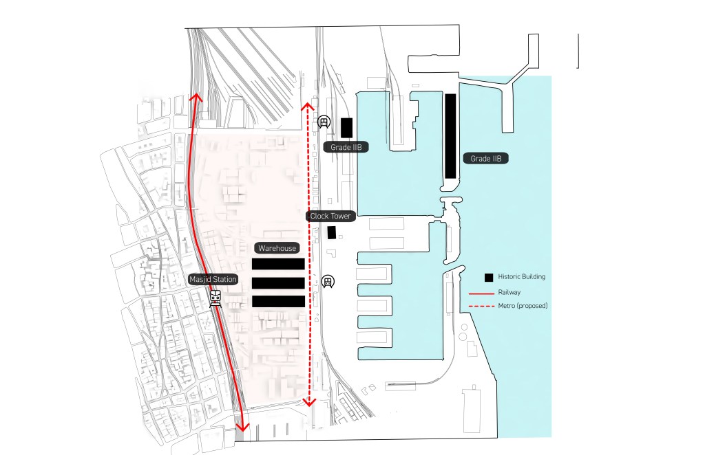
Site Analysis
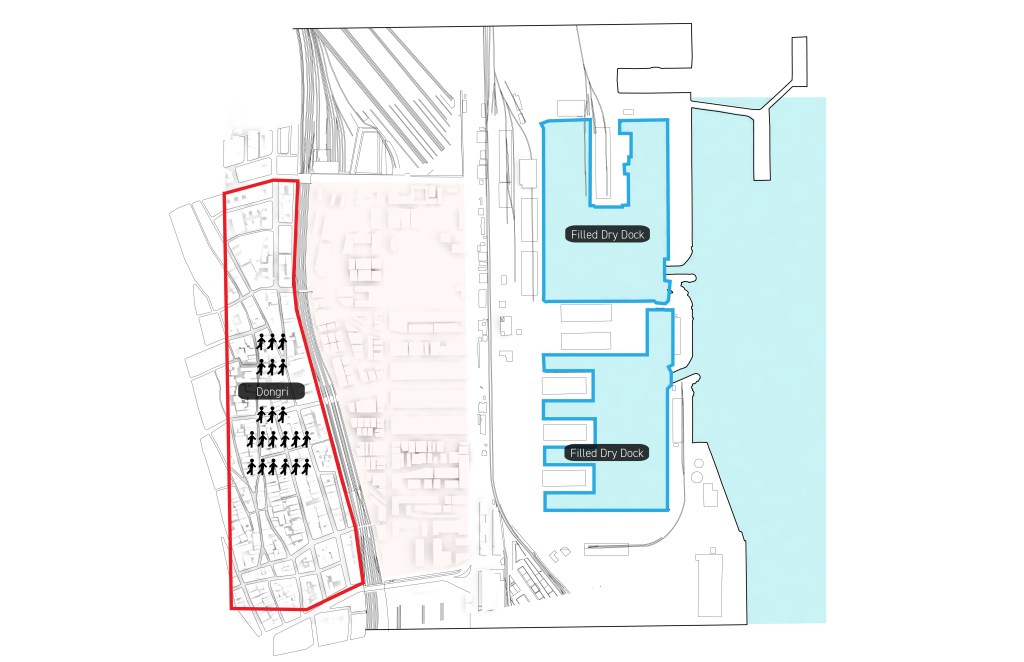
Barriers from the railway and fast traffic.The site is adjacent to Dongri – a highly populated neighborhood and two docks that have been filled and carved out repeatedly.The site has 350 informal settlements and under- utilized areas as vacant parking lots.The site has important assets such as historical buildings and a transit network.
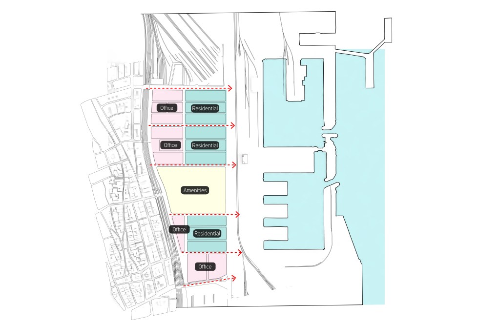
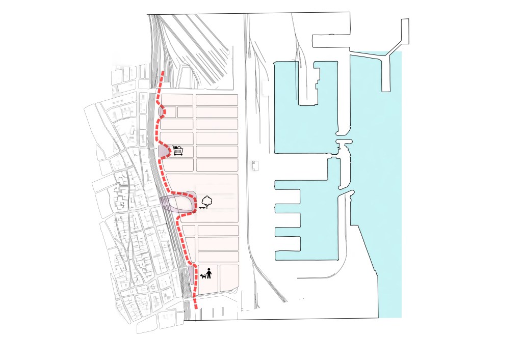
Design Strategies
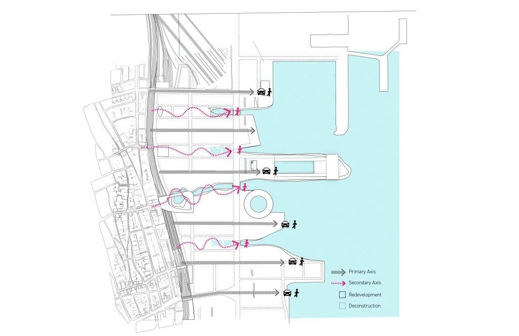
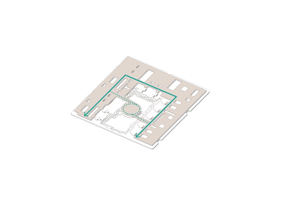
Divide the site into three different functional areas by super-block.Introduce a promenade along the railway with commercials and open-space components. Buildings need to retreat from the railway edge.Bring water into the middle of each superblock to activate the edge and increase the property value.Primary access utilizes the ROW while pedestrians can choose the mid-block “paseo”. Vehicular and non-vehicular traffic are separated.
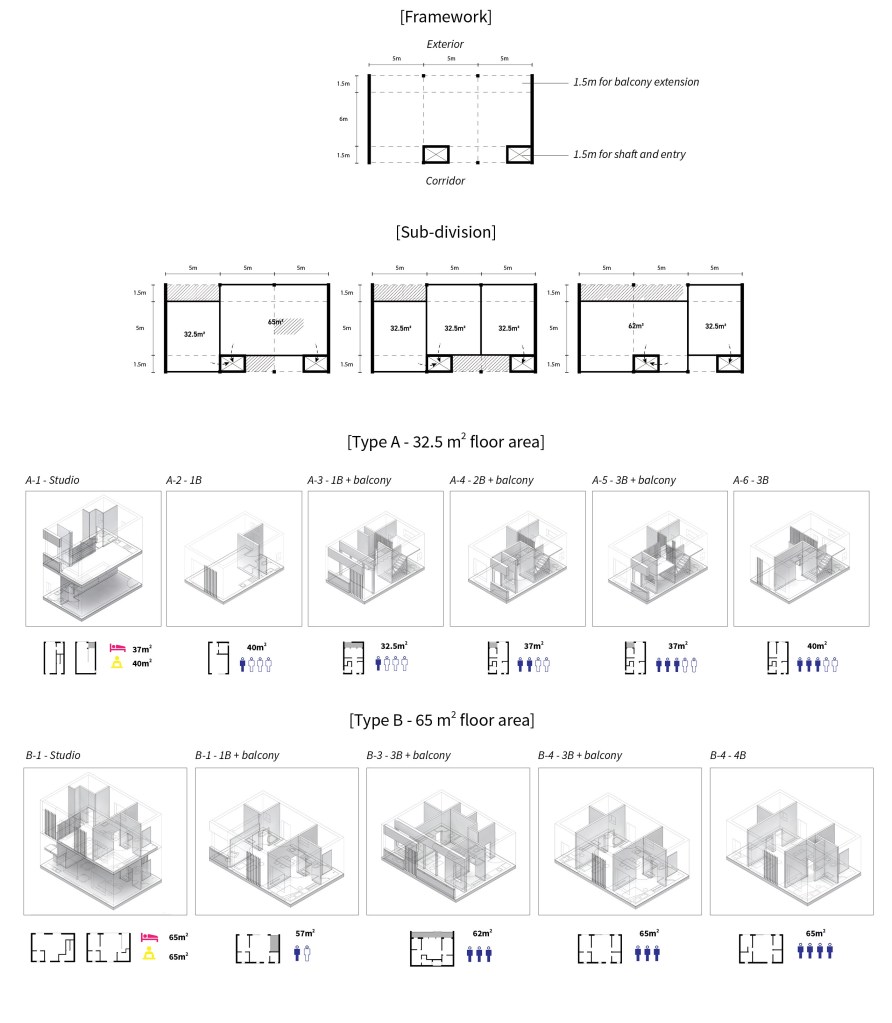
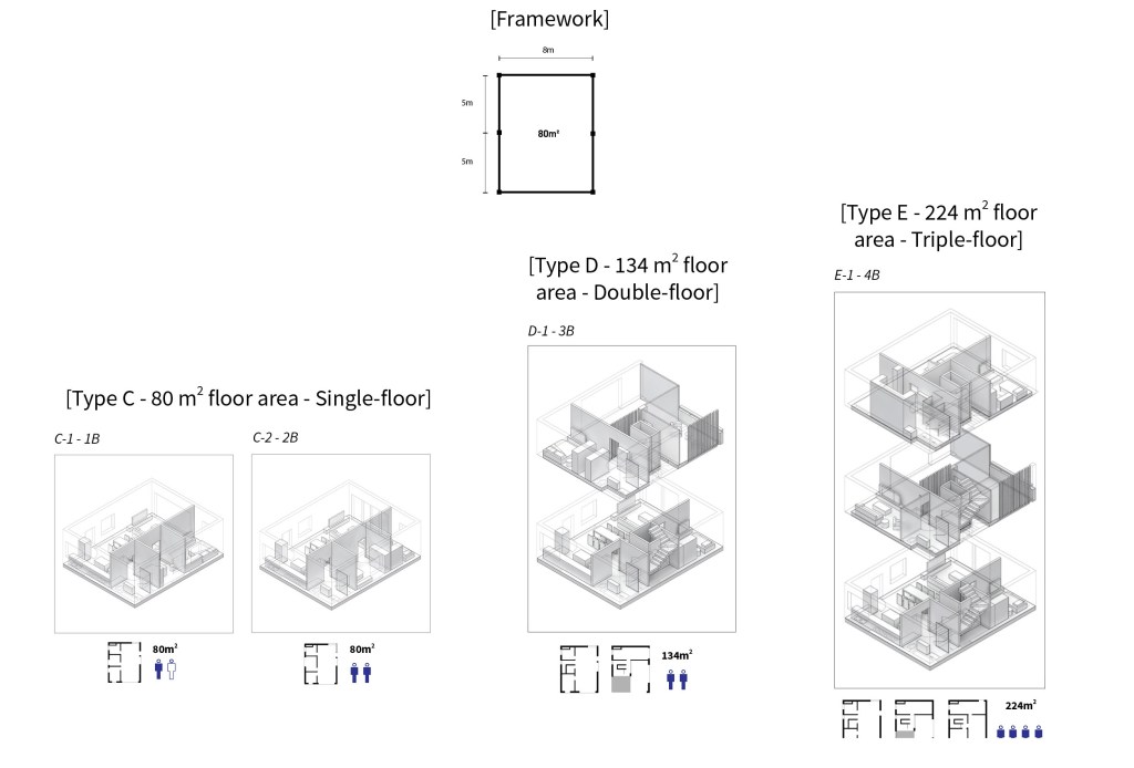
Residential Design
Low-moderate Income Housing Unit Design
Market-rate Housing Unit Design
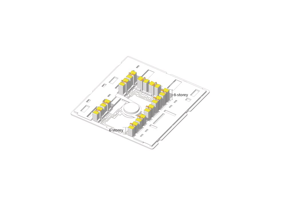
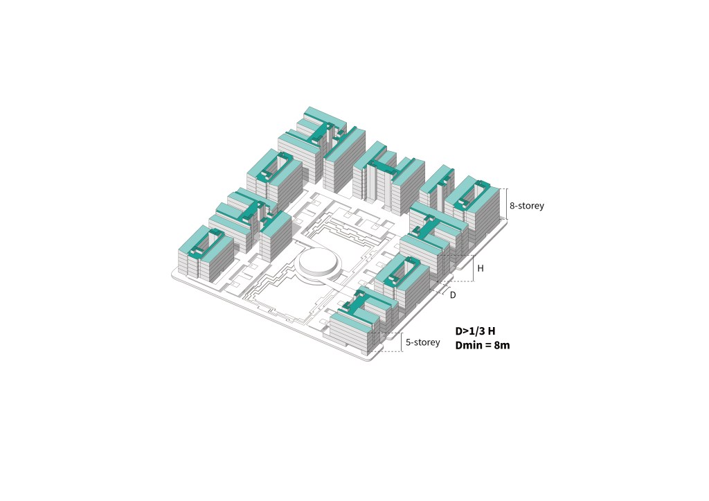
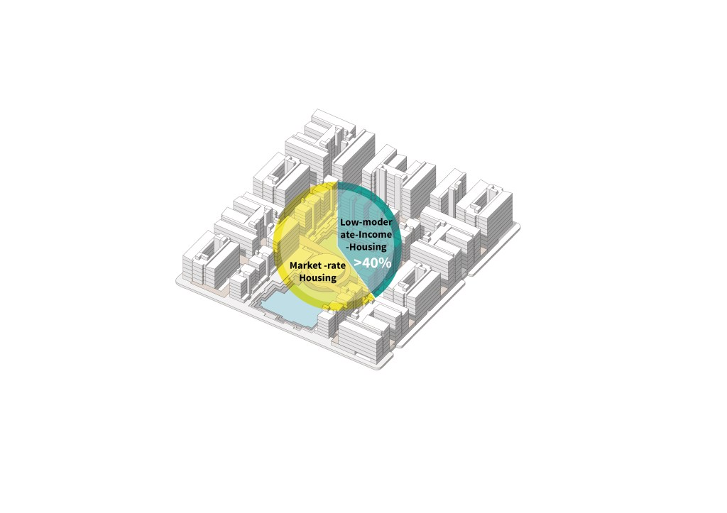
Residential Block Design Strategies
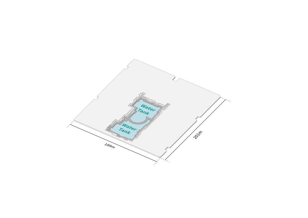
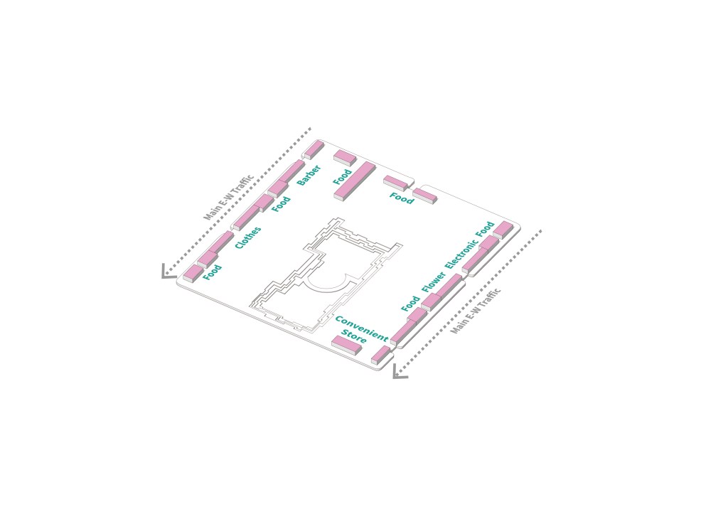
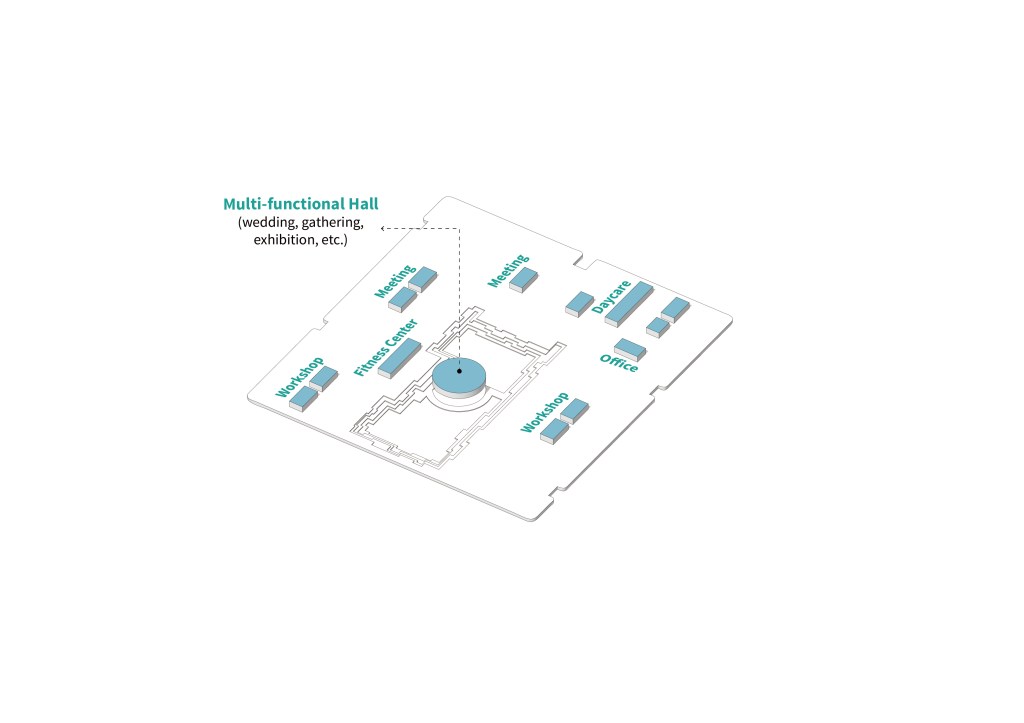
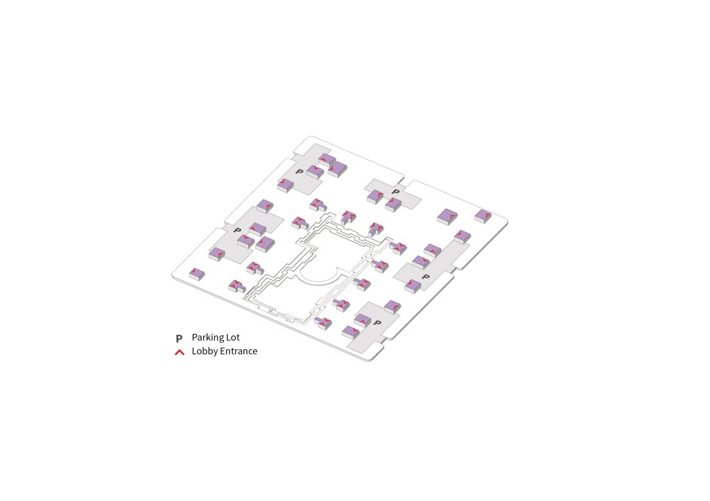
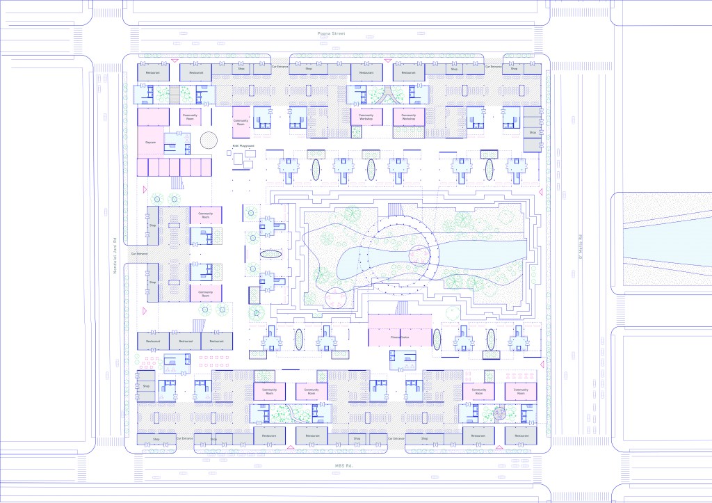
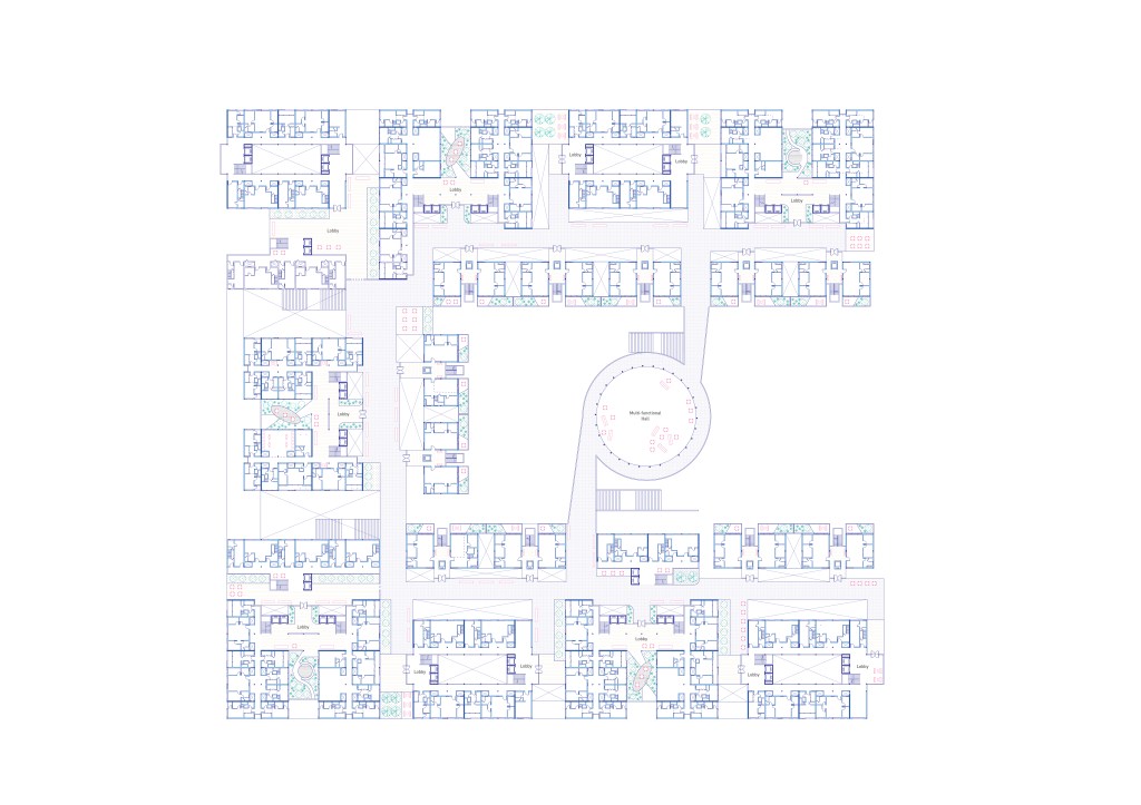
Water TankRetail edges for small and/or women-owned businessFlexible community rooms for meetings and gatheringsLobby at the ground floorThe elevated podium frees up the ground floor and provides circulation on the first-levelMarket-rate housing along the inner courtyard for better viewsLow-to-moderate income housing along the peripheral with regulated densityMinimum 40% GSF of low-to- moderate housing in each block. Relocated residents on-site to be housed first
Block Plan – Ground FloorBlock Plan – Podium Floor